

Understanding Remote Sensing Satellites: A Deep Dive into Their Structure and Applications
Remote sensing satellites are sophisticated tools that orbit Earth, capturing images and data about our planet’s surface without direct physical contact. These satellites play a vital role in various fields, from environmental monitoring and disaster management to urban planning and resource exploration. Understanding the structure and applications of these satellites is key to appreciating their impact on our modern world. This article will explore the fundamental components of remote sensing satellites, the different types of sensors they employ, and the wide array of applications they serve.
The Anatomy of a Remote Sensing Satellite
A remote sensing satellite is a complex system designed for a specific mission. While designs vary, most share common structural and functional components. These components work in harmony to collect, process, and transmit data back to Earth.
The Satellite Bus
The satellite bus, also known as the platform, provides the essential support systems for the satellite’s payload. It’s the backbone that houses and powers the various subsystems. Key elements of the satellite bus include:
- Structure: This is the physical framework that holds all the satellite’s components together. It must be strong enough to withstand the rigors of launch and the harsh environment of space, yet lightweight to minimize launch costs. Materials like aluminum alloys and composites are commonly used.
- Power System: Satellites rely on electrical power to operate. This system typically includes solar panels to convert sunlight into electricity and batteries to store power for when the satellite is not in direct sunlight or when peak power is needed. The size and efficiency of the solar panels are critical for long-term operation.
- Attitude Determination and Control System (ADCS): This system is responsible for orienting the satellite in space. It ensures that the sensors are pointed in the correct direction to capture the desired imagery and that the solar panels are aimed at the sun for optimal power generation. Components include star trackers, sun sensors, gyroscopes, and reaction wheels or thrusters.
- Thermal Control System: Space presents extreme temperature variations. The thermal control system maintains the satellite’s components within their operational temperature ranges, preventing overheating or freezing. This can involve insulation, radiators, and heaters.
- Command and Data Handling (C&DH) System: This is the satellite’s “brain.” It receives commands from ground stations, processes them, and manages the satellite’s operations. It also collects, formats, and stores the data gathered by the sensors before transmission.
- Telemetry, Tracking, and Command (TT&C) System: This subsystem handles communication between the satellite and ground stations. It transmits status information (telemetry) about the satellite’s health and performance, receives commands, and allows ground controllers to track the satellite’s position.
- Propulsion System: Some satellites have propulsion systems, which use thrusters to make small adjustments to their orbit or orientation. This is important for maintaining the correct orbital path or for maneuvering the satellite.
The Payload: The Sensor System
The payload is the primary reason the satellite is in orbit – it’s the equipment that performs the remote sensing task. The most critical part of the payload is the sensor system, which captures data about Earth’s surface. Sensors can be broadly categorized into two types: passive and active.
Passive Sensors
Passive sensors detect naturally occurring radiation, primarily sunlight reflected from Earth’s surface or emitted thermal radiation from the surface. They do not emit their own energy.
- Optical Sensors: These sensors work similarly to the human eye, capturing visible light and near-infrared radiation. They are used to create images that show features like land cover, vegetation health, and water bodies. Examples include multispectral and hyperspectral scanners.
- Multispectral Sensors: These sensors capture data in several broad wavelength bands (e.g., blue, green, red, near-infrared). Each band highlights different characteristics of the Earth’s surface. For instance, vegetation strongly reflects near-infrared light, making it useful for assessing plant health.
- Hyperspectral Sensors: These sensors capture data in many narrow, contiguous wavelength bands. This allows for a much more detailed spectral analysis, enabling the identification of specific materials and subtle differences in surface composition that multispectral sensors might miss.
- Thermal Infrared Sensors: These sensors measure the thermal radiation emitted by the Earth’s surface. This data is used to determine surface temperatures, which is valuable for monitoring volcanic activity, tracking wildfires, assessing water quality, and studying climate patterns.
Active Sensors
Active sensors emit their own energy and then detect the radiation that is reflected or scattered back from the Earth’s surface. This allows them to operate day or night and through cloud cover, depending on the type of energy emitted.
- Radar (Radio Detection and Ranging) Sensors: Radar systems emit microwave pulses that penetrate clouds, rain, and darkness. They are excellent for mapping terrain, monitoring soil moisture, tracking sea ice, and observing changes in land use. Different types of radar include:
- Synthetic Aperture Radar (SAR): SAR is a sophisticated radar technique that uses the motion of the satellite to simulate a much larger antenna, achieving higher resolution imagery. It can detect subtle changes in surface texture and structure.
- Scatterometers: These sensors measure the backscatter of radar signals to determine surface roughness and wind speed over oceans.
- Lidar (Light Detection and Ranging) Sensors: Lidar systems emit laser pulses and measure the time it takes for the pulses to return after reflecting off the surface. This provides highly accurate elevation data, enabling the creation of detailed topographic maps and 3D models of the terrain. It is particularly useful for mapping forest canopy structure and measuring the height of buildings.
- Altimeters: These sensors measure the distance between the satellite and the Earth’s surface, typically over oceans. They are used to determine sea surface height, which helps in studying ocean currents, tides, and sea level rise.
Data Acquisition and Processing
Once a satellite collects data, it needs to be transmitted to Earth and processed into a usable format.
Data Transmission
The data collected by the sensors is stored onboard the satellite and then transmitted to ground receiving stations via radio waves. The rate at which data can be transmitted depends on the satellite’s antenna, the ground station’s capabilities, and the distance between them. For high-resolution imagery or large volumes of data, specialized high-bandwidth communication systems are used.
Ground Stations and Data Processing Centers
Ground stations are strategically located around the world to ensure continuous reception of data as the satellite orbits. Once received, the raw data is sent to data processing centers. Here, sophisticated software is used to:
- Radiometric Correction: This process corrects for variations in sensor sensitivity and atmospheric effects that can alter the brightness values of the pixels.
- Geometric Correction: This corrects for distortions caused by the satellite’s movement, the Earth’s curvature, and the sensor’s viewing angle. This ensures that the imagery accurately represents the geographic locations on the ground.
- Image Enhancement: Techniques are applied to improve the visual quality of the imagery, making features more discernible. This can include contrast stretching, filtering, and sharpening.
- Data Analysis: Specialized algorithms are used to extract specific information from the imagery, such as classifying land cover types, detecting changes over time, or measuring vegetation indices.
Applications of Remote Sensing Satellites
The data provided by remote sensing satellites has revolutionized our ability to monitor and understand Earth. Its applications span numerous sectors:
Environmental Monitoring
Remote sensing is indispensable for tracking the health of our planet.
- Climate Change Studies: Satellites monitor global temperatures, sea levels, ice cover, and greenhouse gas concentrations, providing critical data for understanding and predicting climate change. For example, data from satellites like the Copernicus Sentinel series helps track changes in polar ice caps and monitor deforestation rates.
- Deforestation and Land Use Change: High-resolution imagery allows scientists to map forest cover, detect illegal logging, and monitor how land is being used and transformed over time. This is crucial for conservation efforts and sustainable land management.
- Water Resource Management: Satellites can monitor the extent of lakes and rivers, assess snowpack for water supply predictions, and detect pollution in water bodies. Thermal sensors can also help monitor water temperature, which is important for aquatic ecosystems.
- Air Quality Monitoring: Satellites equipped with specialized sensors can detect and map the distribution of atmospheric pollutants like ozone, nitrogen dioxide, and particulate matter, helping to identify pollution sources and track their spread.
- Oceanography: Satellites track ocean currents, measure sea surface temperature, monitor ocean color (indicating phytoplankton abundance), and detect oil spills. This information is vital for understanding marine ecosystems and predicting weather patterns.
Disaster Management and Response
In times of crisis, remote sensing satellites provide invaluable real-time information.
- Flood Mapping: Satellites can quickly map the extent of flooded areas, helping emergency responders to assess damage, plan rescue operations, and allocate resources effectively. SAR imagery is particularly useful as it can penetrate cloud cover, which often accompanies heavy rainfall.
- Wildfire Monitoring: Satellites detect the initial outbreak of fires, monitor their spread, and assess the severity of burned areas. Thermal sensors can identify active fire fronts, while optical imagery can map the extent of damage after the fire has subsided.
- Earthquake and Tsunami Impact Assessment: Following major seismic events, satellites can provide rapid damage assessments by comparing pre- and post-disaster imagery, identifying damaged infrastructure and affected populations. They can also monitor sea level changes associated with tsunamis.
- Volcanic Activity Monitoring: Satellites can detect thermal anomalies associated with volcanic activity, track ash plumes, and monitor ground deformation, providing early warnings of potential eruptions.
Agriculture and Food Security
Precision agriculture relies heavily on satellite data.
- Crop Health and Yield Estimation: By analyzing multispectral and hyperspectral data, farmers can assess crop health, detect signs of disease or nutrient deficiency, and estimate potential yields. This allows for targeted interventions, such as applying fertilizer or pesticides only where needed.
- Soil Moisture Monitoring: Radar and microwave sensors can measure soil moisture levels, helping farmers optimize irrigation schedules and conserve water.
- Land Suitability Analysis: Satellite data can be used to assess the suitability of land for different crops based on soil type, topography, and climate.
Urban Planning and Infrastructure
Satellites aid in the development and management of urban areas.
- Urban Growth Monitoring: High-resolution imagery allows city planners to track urban expansion, monitor land use changes, and identify areas for future development.
- Infrastructure Assessment: Satellites can be used to monitor the condition of roads, bridges, and other infrastructure, identifying potential problems before they become critical.
- Mapping and Cartography: Satellites are fundamental to creating accurate maps, including topographic maps, land cover maps, and digital elevation models, which are essential for planning and navigation.
Resource Exploration
Identifying and managing natural resources is another key application.
- Mineral and Oil Exploration: Certain geological formations and mineral deposits have distinct spectral signatures that can be detected by specialized satellite sensors, aiding in the search for valuable resources.
- Forestry Management: Satellites help monitor forest health, assess timber resources, and track changes in forest cover, supporting sustainable forestry practices.
Defense and Security
Remote sensing satellites are also crucial for national security.
- Reconnaissance and Surveillance: Satellites provide detailed imagery for monitoring borders, tracking military movements, and assessing security threats.
- Disaster Monitoring for Humanitarian Aid: In conflict zones or areas affected by natural disasters, satellites can provide crucial information to guide humanitarian aid efforts.
The Future of Remote Sensing Satellites
The field of remote sensing is constantly evolving. Advances in sensor technology, data processing capabilities, and artificial intelligence are leading to even more powerful applications.
- Higher Resolution and More Frequent Data: Future satellites will offer even higher spatial and spectral resolutions, providing more detailed and nuanced information. The ability to collect data more frequently will allow for near real-time monitoring of dynamic events.
- CubeSats and Small Satellites: The development of smaller, more affordable satellites, such as CubeSats, is democratizing access to space-based data. These smaller satellites can be launched in constellations, providing global coverage and rapid revisit times.
- Integration with Other Data Sources: Remote sensing data is increasingly being integrated with other data sources, such as ground-based sensors and social media information, to create more comprehensive and actionable insights.
- AI and Machine Learning: Artificial intelligence and machine learning are transforming how satellite data is analyzed. These technologies can automate complex tasks, identify patterns that humans might miss, and accelerate the extraction of valuable information.
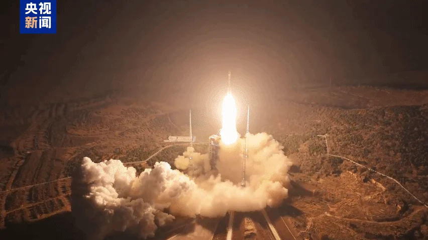
The launch of satellites like China’s Yaogan-50 03 remote sensing satellite, as reported by CGTN, highlights the ongoing global investment and development in this critical technology. Such missions contribute to a growing network of Earth observation capabilities, enhancing our understanding of the planet and our ability to manage its resources and respond to its challenges.
Conclusion
Remote sensing satellites are sophisticated instruments that provide an unparalleled view of our planet. From their intricate structural components and diverse sensor systems to their wide-ranging applications in environmental monitoring, disaster response, agriculture, and beyond, these satellites are indispensable tools for scientific research, governmental planning, and commercial enterprises. As technology continues to advance, the capabilities of remote sensing satellites will only grow, offering even greater insights into the complex systems that govern our world and enabling us to address the challenges of the future with greater knowledge and precision.


Conversation
0 Comments