

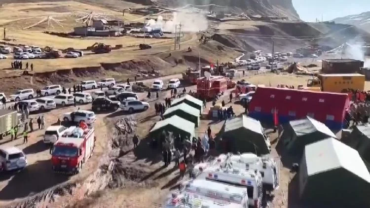
The world of disaster response is constantly evolving, with new technologies emerging to help us better prepare for and react to emergencies. From earthquakes to floods, the ability to quickly assess damage, communicate effectively, and coordinate rescue efforts can make a critical difference in saving lives and minimizing harm. This is where advanced technological solutions, such as satellite imagery and drone deployment, play an increasingly vital role. These tools offer unprecedented perspectives and capabilities, transforming how organizations approach disaster management.
The integration of these technologies is not just about having the latest gadgets; it’s about creating a more robust and responsive system. Satellites provide a broad overview of affected areas, allowing for rapid mapping of damage and identification of critical infrastructure that may be compromised. Drones, on the other hand, offer a more granular view, capable of reaching difficult or dangerous locations to provide real-time visual information and even deliver essential supplies. Together, they form a powerful combination for understanding the scope of a disaster and directing resources efficiently.
This article will explore the multifaceted applications of satellite and drone technology in disaster response. We will examine how these tools are used for early warning systems, damage assessment, search and rescue operations, and logistical support. By understanding their capabilities and limitations, we can better appreciate their impact on saving lives and rebuilding communities in the aftermath of a crisis. The goal is to provide a clear picture of how these technological advancements are shaping the future of disaster management.
The Role of Satellites in Disaster Response
Satellites have become indispensable tools in modern disaster management. Their ability to survey vast areas from space provides a unique vantage point that ground-based methods cannot match. This perspective is crucial for understanding the scale of a disaster and for planning effective response strategies.
Early Warning and Monitoring
One of the primary uses of satellites is in early warning systems. For events like hurricanes or typhoons, weather satellites track storm formation and movement, providing crucial lead time for evacuations and preparations. Similarly, satellites equipped with sensors can monitor seismic activity, ground deformation, and changes in water levels, which can indicate potential earthquakes, volcanic eruptions, or floods. By continuously observing these indicators, authorities can issue timely alerts to affected populations, giving them precious hours or even days to seek safety.
The research and development in this area are ongoing, with new satellite constellations being launched to provide higher resolution imagery and more frequent revisits of critical areas. This enhanced monitoring capability allows for the detection of subtle changes that might otherwise go unnoticed, potentially preventing disasters or mitigating their impact. For instance, monitoring deforestation or land degradation can help predict areas prone to landslides or flash floods.
Damage Assessment and Mapping
Following a disaster, rapid and accurate damage assessment is critical for allocating resources effectively. Satellites equipped with high-resolution cameras can capture detailed images of affected regions. These images can be compared with pre-disaster data to identify damaged buildings, destroyed infrastructure, and blocked roads. This information is invaluable for emergency responders, helping them to prioritize search and rescue efforts, plan evacuation routes, and determine where to send aid.
The use of synthetic aperture radar (SAR) satellites is particularly noteworthy. SAR can penetrate cloud cover and operate day or night, making it effective even in adverse weather conditions that often accompany natural disasters. This allows for consistent data collection, regardless of visibility, which is a significant advantage in disaster situations. The data gathered from these satellites can be processed to create detailed maps showing the extent of damage, helping to guide relief operations and long-term recovery planning.
Communication and Connectivity
In the chaotic aftermath of a disaster, communication infrastructure is often severely damaged, leaving affected areas isolated. Satellites play a crucial role in restoring communication links. Satellite-based internet services can be quickly deployed to provide emergency responders with vital communication channels for coordinating their efforts. This ensures that rescue teams can stay in touch with command centers, share real-time information, and request necessary resources.
Furthermore, satellite phones offer a reliable means of communication when terrestrial networks fail. These devices can connect individuals and teams to the outside world, facilitating communication for both emergency personnel and affected civilians. The China Aerospace Science and Technology Corporation (CASC), for example, has been instrumental in coordinating satellite resources for emergency communications in disaster zones, opening multiple high-throughput satellite internet lines for emergency management and telecom operators. This highlights the practical application of satellite technology in ensuring connectivity when it is needed most.
The Rise of Drones in Disaster Response
Drones, also known as unmanned aerial vehicles (UAVs), have emerged as a powerful and versatile tool in disaster response. Their ability to fly at low altitudes, navigate complex environments, and carry various payloads makes them ideal for a wide range of tasks that are difficult or dangerous for human responders.
Real-time Situational Awareness
Drones provide an immediate, on-the-ground perspective of a disaster zone. Equipped with high-definition cameras, thermal sensors, and other imaging technologies, they can stream live video footage to emergency command centers. This real-time situational awareness allows responders to quickly understand the scope of the damage, identify hazards like fires or unstable structures, and locate trapped individuals. Unlike satellites, which provide a broader but less immediate view, drones can offer a detailed, up-close look at specific areas of concern.
The agility of drones allows them to access areas that may be inaccessible to manned aircraft or ground teams, such as collapsed buildings or debris-filled streets. This capability is critical for conducting rapid initial assessments and for guiding the deployment of rescue teams to the most critical locations. The Aviation Industry Corporation of China (AVIC), for instance, has deployed Wing Loong drones to observe damage and maintain communications in earthquake-affected zones, showcasing their effectiveness in providing vital aerial reconnaissance.
Search and Rescue Operations
Drones equipped with thermal imaging cameras are particularly effective in search and rescue operations. These cameras can detect heat signatures, allowing rescuers to find individuals who may be hidden by debris or darkness. This is invaluable in situations where visual confirmation is difficult, such as during nighttime operations or in areas with heavy smoke. The ability of drones to hover and maneuver precisely also allows them to get close to potential survivors without disturbing the scene, providing crucial information for extraction efforts.
In addition to thermal imaging, drones can be equipped with loudspeakers to communicate with trapped individuals, offering reassurance and instructions. They can also carry small payloads, such as medical supplies or communication devices, to those in need. The People’s Liberation Army Air Force has also utilized drones for damage surveys, demonstrating their broad application in disaster assessment and support.
Delivering Aid and Supplies
Drones are increasingly being used to deliver essential supplies to hard-to-reach areas. In the immediate aftermath of a disaster, roads may be impassable, and traditional delivery methods may be impossible. Drones can transport small but critical items such as medicine, blood, food, and communication devices directly to isolated communities or individuals. This capability can be life-saving, ensuring that essential aid reaches those who need it most without delay.
The development of larger, more capable drones is expanding the potential for aerial delivery. These advanced UAVs can carry heavier payloads over longer distances, making them suitable for delivering more substantial supplies or for supporting longer-term recovery efforts. This technology offers a promising solution for overcoming logistical challenges in remote or disaster-stricken regions.
Infrastructure Inspection and Reconstruction Planning
Beyond immediate rescue efforts, drones are also valuable for inspecting damaged infrastructure, such as bridges, power lines, and buildings. They can provide detailed visual inspections without requiring personnel to enter potentially dangerous structures. This information is vital for assessing the safety of infrastructure and for planning repair and reconstruction efforts. By identifying structural weaknesses or damage, engineers can make informed decisions about repair priorities and safety protocols.
The data collected by drones can be used to create 3D models of damaged areas, providing a comprehensive understanding of the physical impact of the disaster. This detailed mapping aids in the planning of reconstruction projects, ensuring that rebuilding efforts are efficient and effective.
Integrating Satellite and Drone Technology for Enhanced Response
The true power of these technologies lies in their synergistic integration. While satellites offer a broad, macro-level view, drones provide detailed, micro-level insights. Combining their capabilities creates a comprehensive and dynamic approach to disaster management.
Complementary Perspectives
Satellites provide a wide-area overview, ideal for initial damage assessment and understanding the overall impact of a disaster. They can quickly map affected regions, identify major infrastructure damage, and track the movement of large-scale events like floods or wildfires. This broad perspective helps in understanding the context of the disaster and in allocating resources to the most severely impacted zones.
Drones, on the other hand, offer a close-up, real-time view of specific areas. They can navigate complex terrain, enter damaged buildings, and provide detailed visual information that satellites cannot capture. When used in conjunction with satellite data, drones can verify initial assessments, provide more granular details about specific damage, and guide rescue teams on the ground. For example, satellite imagery might indicate a collapsed bridge, while drone footage can show the exact extent of the collapse and identify any immediate hazards for rescue crews.
Data Fusion and Analysis
The effective integration of satellite and drone data requires sophisticated data fusion and analysis techniques. By combining information from both sources, emergency managers can create a more complete and accurate picture of the disaster situation. This fused data can be used to generate detailed maps, identify critical needs, and optimize the deployment of resources. Advanced analytics can help to identify patterns, predict future needs, and improve the overall efficiency of the response.
The ability to process and analyze large volumes of data from multiple sources quickly is essential. This often involves the use of artificial intelligence and machine learning algorithms to identify key information, such as the location of survivors or the severity of structural damage. The goal is to transform raw data into actionable intelligence that can guide decision-making in real-time.
Coordinated Operations
Successful disaster response relies on seamless coordination among various agencies and teams. The integration of satellite and drone technologies facilitates this coordination by providing a common operational picture. All stakeholders can access the same real-time information, ensuring that everyone is working with the same understanding of the situation. This shared situational awareness reduces confusion, prevents duplication of efforts, and improves the overall effectiveness of the response.
For instance, a satellite might identify a large area of flooding, while drones can be dispatched to specific neighborhoods within that area to assess the depth of the water, identify stranded individuals, and determine the best routes for evacuation or aid delivery. This coordinated approach, informed by both broad and detailed data, leads to more efficient and targeted interventions.
Challenges and Future Directions
Despite the significant advancements in satellite and drone technology for disaster response, several challenges remain. These include regulatory hurdles, data processing limitations, and the need for standardized protocols.
Regulatory and Airspace Management
The use of drones in disaster zones can be complicated by regulations governing airspace. Emergency responders need clear and streamlined processes for obtaining permission to fly drones, especially in areas where manned aircraft are also operating. Ensuring the safe integration of drones into existing airspace management systems is crucial to prevent accidents and ensure efficient operations. Developing clear guidelines and collaborative frameworks between aviation authorities and disaster response agencies is essential.
Data Processing and Accessibility
The sheer volume of data generated by satellites and drones can be overwhelming. Processing this data quickly and making it accessible to all relevant personnel in a user-friendly format is a significant challenge. Investing in advanced data processing capabilities, cloud-based platforms, and intuitive visualization tools is necessary to overcome this hurdle. Ensuring that responders in the field have access to critical information, even in areas with limited connectivity, is also a priority.
Training and Standardization
Effective use of these technologies requires trained personnel. Developing comprehensive training programs for operators, data analysts, and decision-makers is essential. Standardization of equipment, data formats, and operational procedures across different agencies and organizations will also improve interoperability and efficiency. This will ensure that response efforts are coordinated and effective, regardless of which agencies are involved.
Future Innovations
The future of disaster response technology holds immense promise. We can expect to see further advancements in drone capabilities, such as longer flight times, increased payload capacity, and greater autonomy. Satellite technology will continue to improve with higher resolution imaging, more frequent revisits, and enhanced sensor capabilities. The integration of artificial intelligence and machine learning will play an even larger role in analyzing data and predicting disaster impacts.
Emerging technologies like swarm robotics, where multiple drones work together autonomously, could revolutionize search and rescue operations. Furthermore, the development of integrated command and control systems that seamlessly combine data from satellites, drones, ground sensors, and social media will create a truly comprehensive disaster management ecosystem. The ongoing innovation in this field is critical for building more resilient communities capable of withstanding and recovering from natural and man-made disasters.
Conclusion
The deployment of satellites and drones has fundamentally transformed the landscape of disaster response. These technologies offer unparalleled capabilities for monitoring, assessment, communication, and aid delivery, significantly enhancing our ability to respond effectively to emergencies. From providing early warnings and detailed damage assessments via satellites to offering real-time aerial reconnaissance and critical supply delivery through drones, these tools are proving to be life-saving assets.
The synergy between satellite and drone technology, when integrated effectively, provides a comprehensive view of disaster situations, enabling faster, more informed decision-making and more efficient allocation of resources. While challenges related to regulation, data management, and training persist, ongoing innovation and collaboration are paving the way for even more advanced and integrated solutions. As these technologies continue to evolve, they will undoubtedly play an even more critical role in protecting lives and communities in the face of adversity, building a more resilient future for all.


Conversation
0 Comments